


El Capitan Map: 8.5"x11"
Made by
Print With Shapeways
 Choose Your Material
 Choose your color and finish
$463.16
Have a question about this product?
contact the designerYou must be logged in and verified to contact the designer.
Product Description
Interactive 3D Viewer
If you would like a custom relief map, contact me through my website or through Shapeways. Check out photos of my other 3D prints.
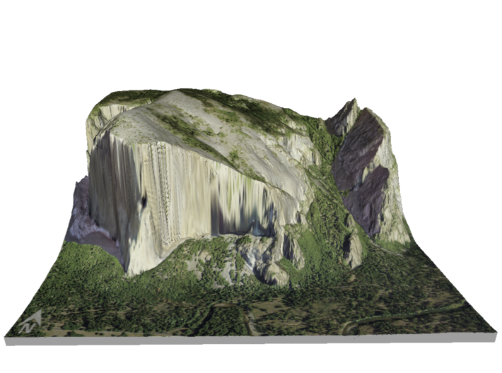
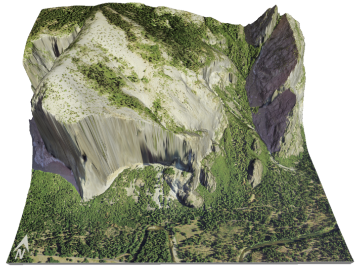
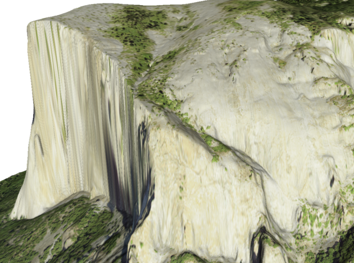
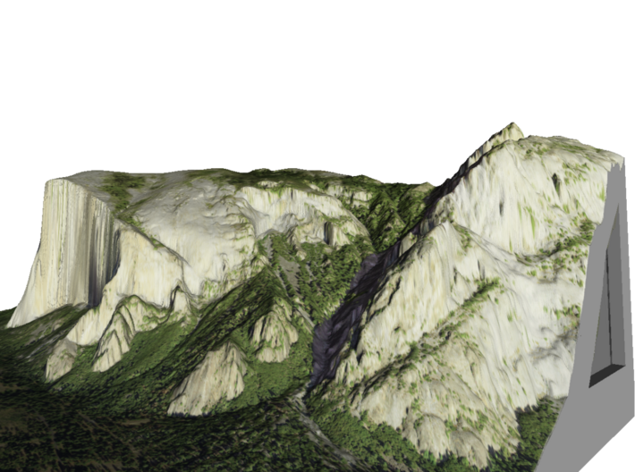
El Capitan (Spanish for The Captain, The Chief) is a vertical rock formation in Yosemite National Park, located on the north side of Yosemite Valley, near its western end. The granite monolith extends about 3,000 feet (900 m) from base to summit along its tallest face and is one of the world's favorite challenges for rock climbers and BASE jumpers.[citation needed]
The formation was named "El Capitan" by the Mariposa Battalion when they explored the valley in 1851. El Capitan ("the captain", "the chief") was taken to be a loose Spanish translation of the local Native American name for the cliff, variously transcribed as "To-to-kon oo-lah" or "To-tock-ah-noo-lah" (Miwok language).[4] It is unclear if the Native American name referred to a specific tribal chief or simply meant "the chief" or "rock chief".[5] In modern times, the formation's name is often contracted to "El Cap", especially among rock climbers and BASE jumpers.
The top of El Capitan can be reached by hiking out of Yosemite Valley on the trail next to Yosemite Falls, then proceeding west. For climbers, the challenge is to climb up the sheer granite face. There are many named climbing routes, all of them arduous, including Iron Hawk and Sea of Dreams, for example.
Source: Wikipedia
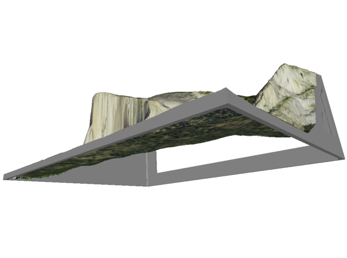
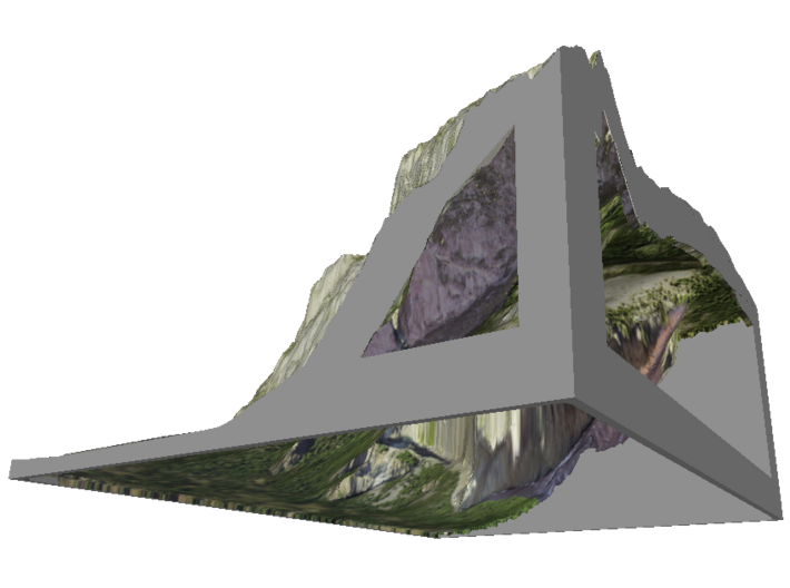
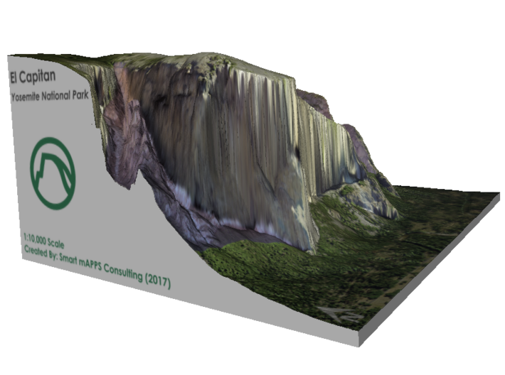
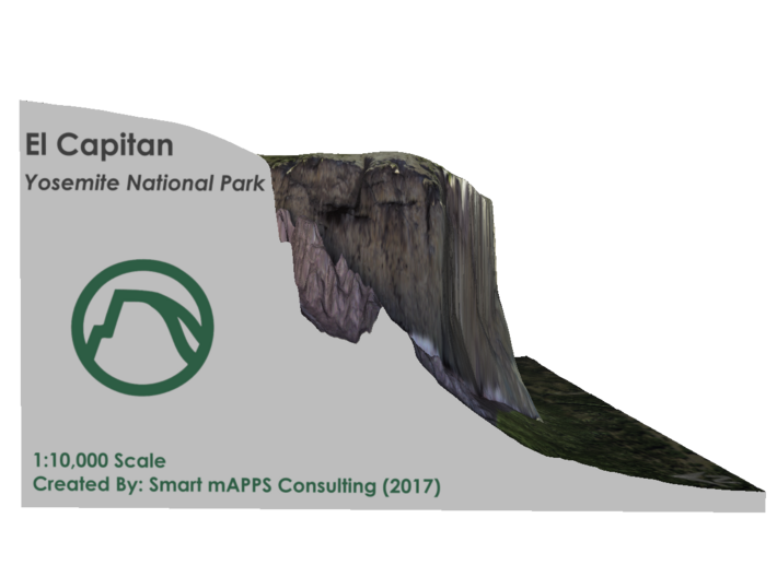
The model is created at a scale of 1:10,000 with NO vertical exaggeration. It features a built-in base, so it sits perfectly on a desk or in a frame.
Model Data Sources:USDA and This material is based on [data, processing] services provided by the OpenTopography Facility with support from the National Science Foundation under NSF Award Numbers 1226353 & 1225810
If you would like a custom relief map, contact me through my website or through Shapeways. Check out photos of my other 3D prints.
El Capitan (Spanish for The Captain, The Chief) is a vertical rock formation in Yosemite National Park, located on the north side of Yosemite Valley, near its western end. The granite monolith extends about 3,000 feet (900 m) from base to summit along its tallest face and is one of the world's favorite challenges for rock climbers and BASE jumpers.[citation needed]
The formation was named "El Capitan" by the Mariposa Battalion when they explored the valley in 1851. El Capitan ("the captain", "the chief") was taken to be a loose Spanish translation of the local Native American name for the cliff, variously transcribed as "To-to-kon oo-lah" or "To-tock-ah-noo-lah" (Miwok language).[4] It is unclear if the Native American name referred to a specific tribal chief or simply meant "the chief" or "rock chief".[5] In modern times, the formation's name is often contracted to "El Cap", especially among rock climbers and BASE jumpers.
The top of El Capitan can be reached by hiking out of Yosemite Valley on the trail next to Yosemite Falls, then proceeding west. For climbers, the challenge is to climb up the sheer granite face. There are many named climbing routes, all of them arduous, including Iron Hawk and Sea of Dreams, for example.
Source: Wikipedia
The model is created at a scale of 1:10,000 with NO vertical exaggeration. It features a built-in base, so it sits perfectly on a desk or in a frame.
Model Data Sources:USDA and This material is based on [data, processing] services provided by the OpenTopography Facility with support from the National Science Foundation under NSF Award Numbers 1226353 & 1225810
Details
What's in the box:
El-Cap-8.5x11-v3

Dimensions:
Success Rate:
First To try.
What's this?
Rating:
Mature audiences only.


