Storm to ‘Ramp Up’ the Winds Tonight

Rain, snow, and fog, made for slippery travel Sunday throughout the city. More snow, heavy at times will create dangerous driving conditions as the evening wears on.
Travel Updates:
- Interstate 90 from Sioux Falls to Wall has been shut down.
- Interstate 29 from Sioux falls to the North Dakota border is also closed.
As of late Sunday afternoon, Sioux Falls has only received a few inches of snow. However, you don't have to go very far west or north to find much heavier amounts.
After a considerably calm afternoon the winds are increasing to 25 - 30 mph in open areas.
Todd Heitkamp from the National Weather Service:
The best advice I can give at this point is to stay put and avoid travel if you can.
There is a significant amount of moisture with this system so it's difficult to accurately predict snowfall totals. However, here are the latest projections:
- Sioux Falls: 3 - 6"
- Central and northern South Dakota has potential for 12"+
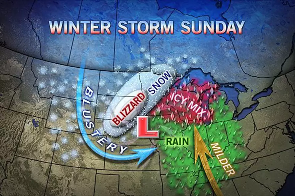
This map, from AccuWeather, shows the path and more snow amounts:
This, all in the same weekend that the New England states are winding down from a major storm with up to 3 feet of snow and 75mph winds. That blizzard, named "Nemo", is blamed for an estimated 700,000 homes without power.
If you must travel keep aware of changing road conditions and white-outs across South Dakota. However, please note that travel is not advised.
Be prepared. This will be a significant winter storm. Stay tuned, stay connected, and remember, travel is not advised.
State news release...I-90 west of Sioux Falls to Wall and I-29 north to Watertown will be closed. Click here for the latest S.D. road and highway conditions.
More From KIKN-FM / Kickin' Country 99.1/100.5