
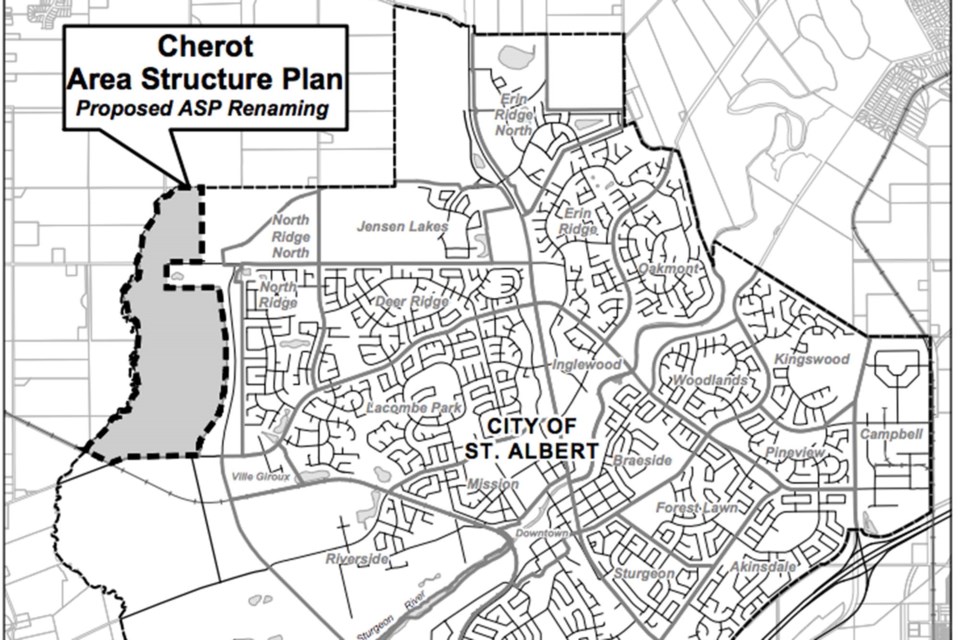
On Monday, council approved changes to the planning of Cherot neighbourhood, formerly known as Range Road 260.
The neighbourhood was officially renamed for better marketability on April 6, where city administration presented development plans for council's approval.
In that meeting, councillors voted to adopt land-use amendments to the city’s Municipal Development Plan (MDP) and the city’s Area Structure Plan (ASP). These land-use amendments included re-designating industrial land as open space, a change that would facilitate new school and park sites to accompany planned residential developments.
During the most recent July 5 meeting, council accepted changes brought forward by administration to address some outstanding inconsistencies within the ASP that Sajid Sifat, a St. Albert city planner, described as "editorial in nature." These small changes were approved without discussion from council.
When the new neighbourhood plan was initially brought forward, however, two items were discussed at length: city administration’s updated recommendation to keep Range Road 260 open while the neighbourhood is developed, and the selection of the Cherot name.
Sifat, who also gave the April 6 presentation, said closing the road would place more traffic elsewhere, potentially leading to concerns with safety. Other reasons for leaving the road open that Sifat listed included the potential for closure to traffic-calming-measure costs, or legal risks, as Alberta’s Municipal Government Act requires the city to compensate any landowners who are negatively affected by a road closure.
Ken Crutchfield, a St. Albert resident, said he did not agree the city should keep the road open. Instead, he argued that closure would complement neighbourhood connectivity between the planned residential development, and that in the long term it could help direct traffic toward Ray Gibbon Drive.
“Instead of letting the road be, the intent should be to design the neighbourhood and have the development fit it,” Crutchfield said.
Coun. Ken MacKay thanked Crutchfield for "bringing value" in raising his concerns, but ultimately argued that closing the road at this point in development might be premature.
"There's some value in leaving it as is and then waiting to get more information," MacKay said. "It's always easier to close something than to open it."
Ultimately, council voted unanimously to leave the road open. On the vote regarding the name change, Coun. Natalie Joly was the only councillor not in favour.
Joly said that though she approved of the French name’s "beauty," she had heard concerns that council’s naming policy was dated.
“That name potentially shouldn’t have been a choice in terms of our commitment to reconciliation,” Joly said.
The Cherot family, included on St. Albert’s significant names list, were early settlers who emigrated to Canada in 1911 from France. The Cherots owned about 112 acres of land around the St. Albert and Edmonton boundaries that they used for farming operations.
Though Joly asked council to pause on selecting the name and revisit it at a later date, administration said a decision was needed immediately to move forward in the process of marketing the neighbourhood.
Recently, council voted to re-examine the city’s naming policy during a June 21 meeting. The process will involve gathering community feedback on pre-existing names for city locations, in addition to revamping the process of finding names for future locations.


