/prod01/vdot-cdn-pxl/media/vdotvirginiagov/news-and-events/news/Road-Work-Ahead-graphic.jpg)
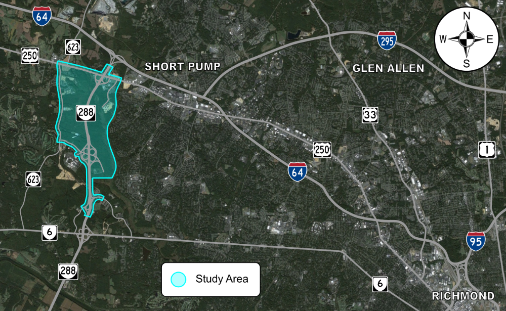
The Virginia Department of Transportation (VDOT) is seeking feedback on a transportation study that will evaluate the transportation network to identify areas for improvement and further define the future roadway network. The study is bounded by I-64 to the north, West Creek Parkway to the south, Route 623 (Hockett Road) to the west, and the Goochland/Henrico County line to the east.
The study team will analyze the existing and planned future transportation network within the study area. This analysis will evaluate the transportation network to identify areas for improvement and further define the future roadway network. The primary objectives and benefits of the West Creek Area Transportation Plan study are listed below.
The Phase 1 survey regarding current transportation issues within the West Creek Area Transportation Access Plan Study area was completed in May 2024. The study team will use the input obtained from the public to better focus on solutions and develop alternatives that address the highest areas of concern.
Estimated start date: TBD
Estimated completion date: TBD
Estimated cost of the project: TBD
The Phase 1 survey regarding current transportation issues within the West Creek Area Transportation Access Plan Study area was completed in May 2024. The study team will use the input obtained from the public to better focus on solutions and develop alternatives that address the highest areas of concern.
No videos currently available
Last updated: May 31, 2024

Please note that this file is not ADA compliant. Choose one of below options:
