Dry Lakes Ridge - Hiking to a Lost World

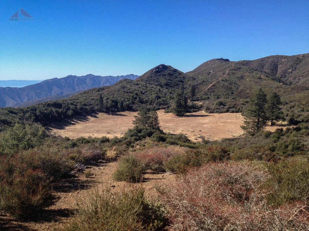
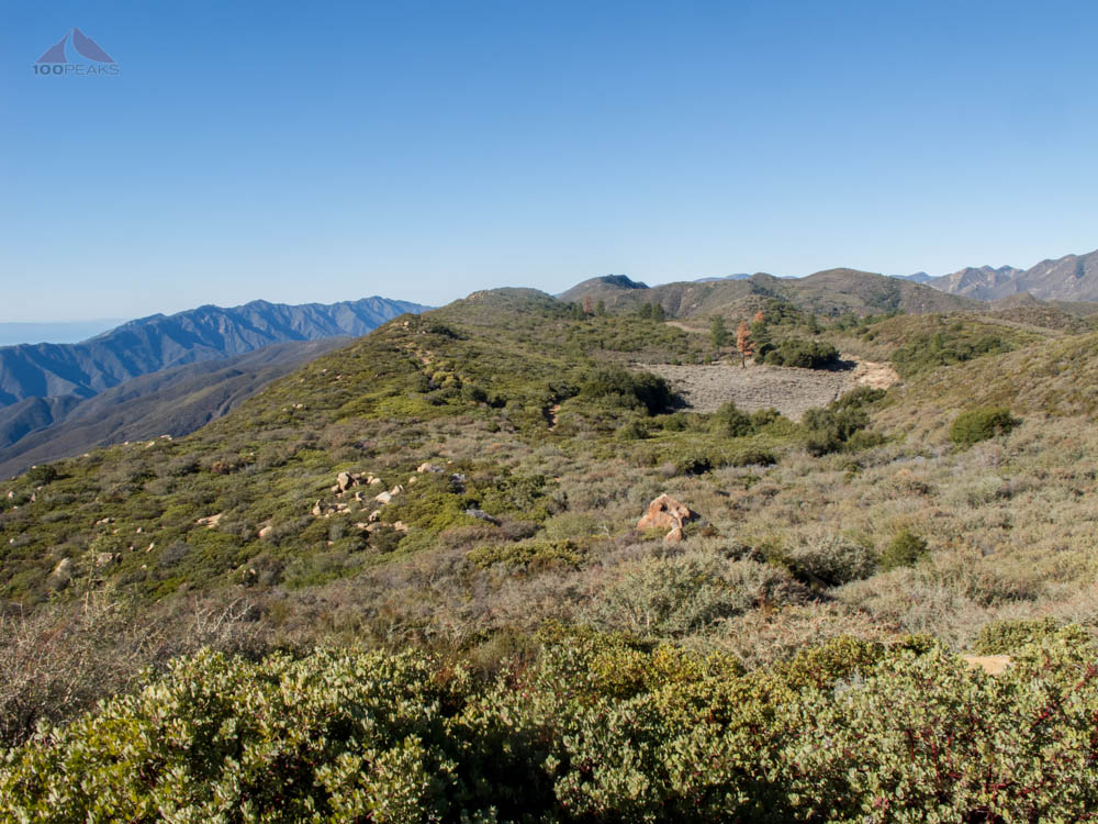
Heading out and looking back to basin #4
Dry Lakes Ridge (No Peak)
Miles: ~5
Date Hiked: 11/11/2012
Trailhead: Highway 33 Turnout
Agency: Los Padres National Forest
For those interested, here is a list of my gear that I have found works well for me. This is, of course, an affiliate link and your enjoyment of these may vary:
After seeing the Dry Lakes Ridge from my hike with Craig Carey to Nordhoff and Chief Peaks, I decided to see what this hike was all about.
11/11/2012
It was cold. My car's thermometer indicated that it was 38F outside. And it was a little breezy. I parked on the side of the 33, put on my new ExOfficio Jacket, and started up the steep use trail that leads to the top of Dry Lakes Ridge.
Immediately, I noticed the sheer quantity of scat on the trail. Most of it was coyote scat, but some of it looked a little bigger. As in bear scat. We've had some intermittent rains lately, so I didn't notice very many tracks at all.

It was pretty cold at the trailhead
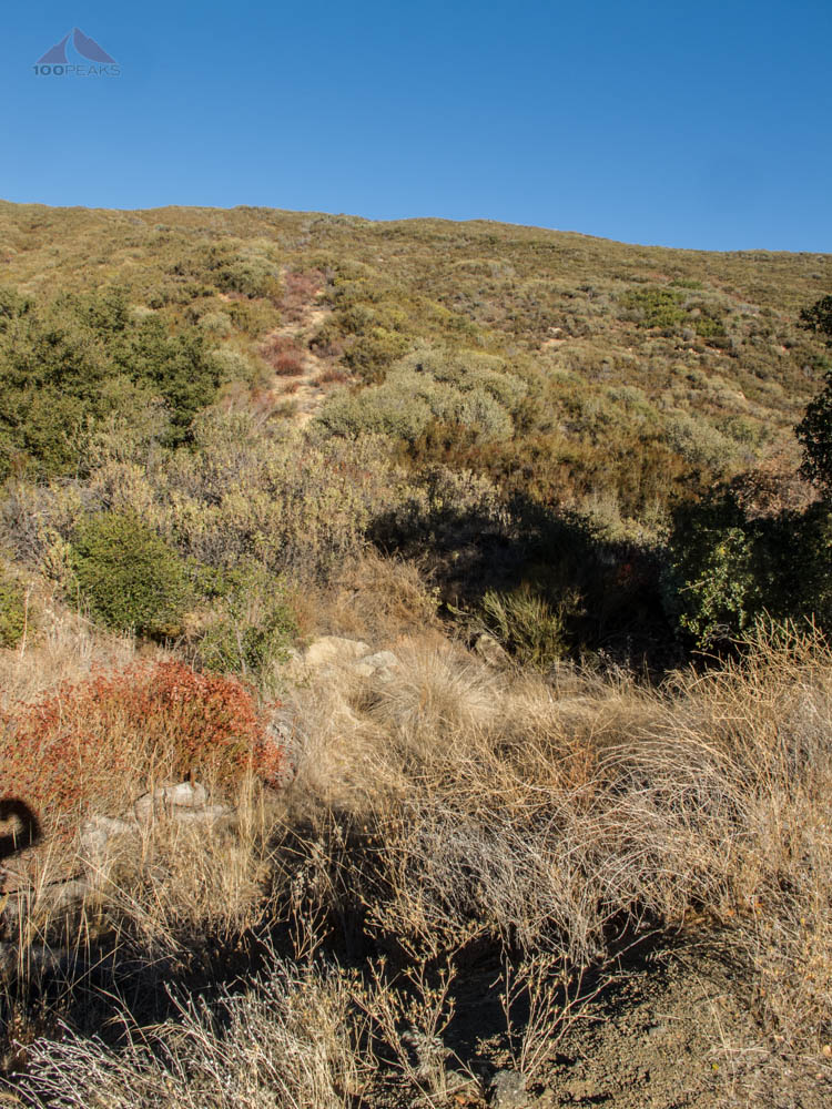
The trail up to Dry Lakes Ridge

Bear Scat on the Dry Lakes Ridge Trail
My body warmed up a bit as I ascended the steep hillside. Even though I was less than a mile from the highway, I started to feel the peace that comes with being in the backcountry.
A large amount of scat typically means few human travelers along this trail. That, and the lack of human footprints, let me know that I would likely have the whole ridge to myself today.
I got to the top of the ridge and was able to see north towards Reyes Peak and Haddock Mountain, as well as into the western edge of the Piedra Blanca formation. Turning south, I could see down into Ojai and the Pacific Ocean beyond.
The trail flattened out as I turned west and followed an old overgrown firebreak at the top of the ridge.
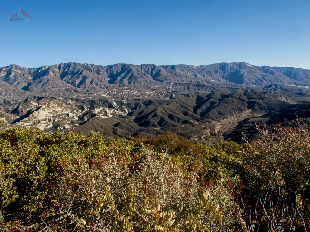
The view north towards Piedra Blanca from Dry Lakes Ridge
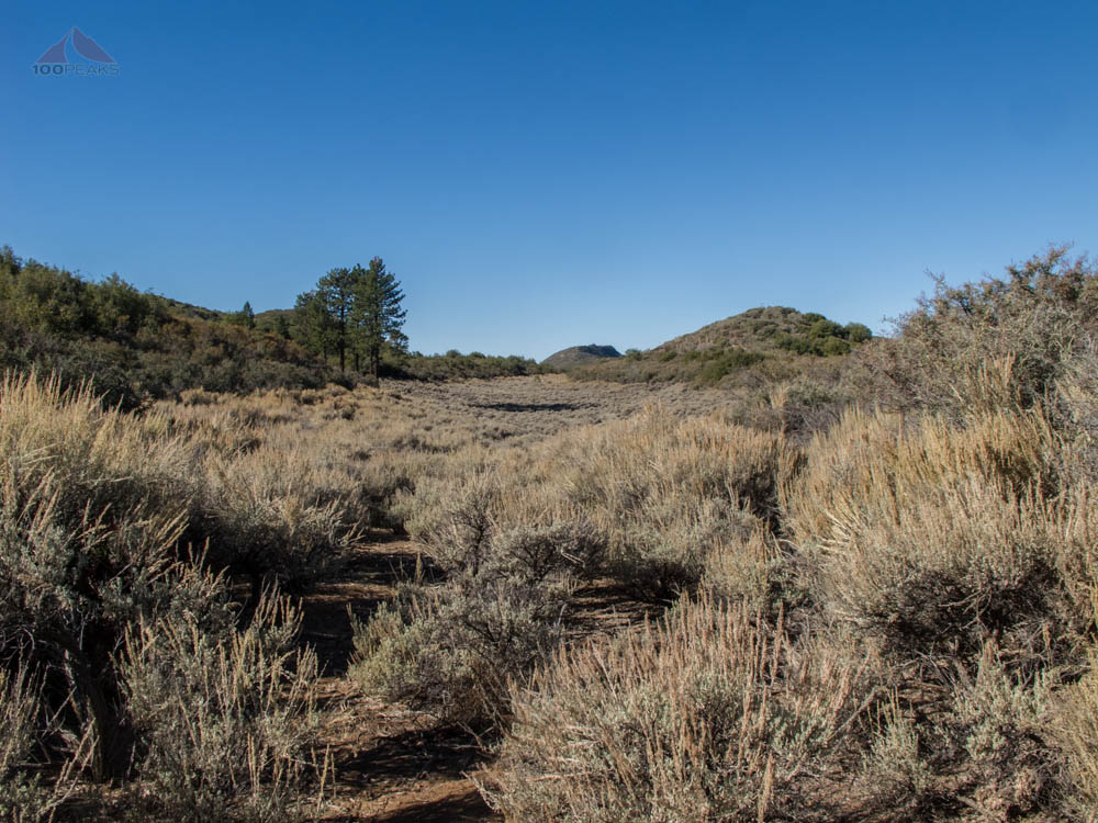
I had to zig zag atop the ridge as I worked my way upward through the thick brush. Sometimes I'd be on the north side of the trail and sometimes I'd be on the south side. I got to what felt like the high point of the trail and I could see the first of several 'dry lakes.'
Dry Lakes Ridge consists of several basins that resemble dry lakes, but they really aren't. They are more meadow-like than anything else.
The first three basins are relatively thick with knee-high Great Basin Sagebrush, but I found an easy path through the bottom of them. I could still see the marks from tires that traveled through here a long time ago.

Overgrown Trail on Dry Lakes Ridge
The first basin on Dry Lakes Ridge
Once I descended into the first basin by leaving the main firebreak and aiming toward a blue ribbon in a large bush, all outside sounds went away. I could no longer hear the highway and each bird chirp was a cannon.
Since I was standing in a small bowl, I was sheltered from the wind and suddenly a lot warmer. I stowed my jacket and continued on the trail, my spirits uplifted.
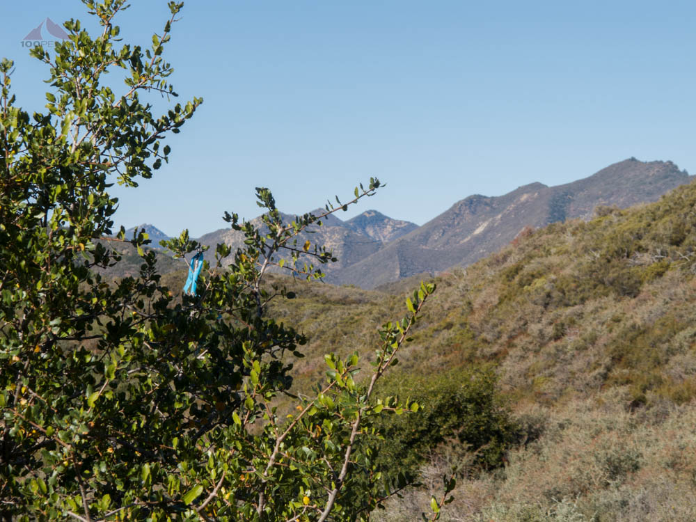
Aim towards this blue ribbon

In the first basin
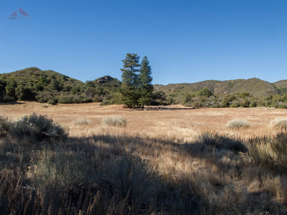
I encountered some tall Ponderosa pine trees and started to imagine camping up here. It would be a silent and very peaceful experience. I also started scouting around for a way to reach the high point of the ridge, but it appeared to be choked by sage and manzanita. I decided to take a look from further down the trail.
I entered two more basins and really started to fall in love with this area. Usually these types of basins appear at the bottom of mountains or in between, but not on the ridge itself. The trail turned back into a fire road as I topped another hill and could see the fourth and largest basin.
In basin #2 on Dry Lakes Ridge

In the third basin on Dry Lakes Ridge
At the edge of the 4th Basin on Dry Lakes Ridge
This basin was large and wide and seemed completely out of place. It was covered in yellow grass and looked as peaceful a place as I've seen in a while. I descended the trail and crossed the basin to the west side. There I found an old ice can stove, turned over and in disrepair.

Ice Can Stove in Dry Lakes Ridge
I continued on the trail to attempt to get to the 5th basin, but the brush was higher than my head, very thick, and I wasn't in the mood to bushwhack through this thickness.

The view to basin #5, brush was too high for my mood
I went back to Basin 4, sat on a fallen log, and ate my lunch in the sun. It was quiet, pleasant, and warm in this basin. I started to think that I'd like to come back here and camp. I'd have to bring my own water, since most of water here is very seasonal, but it would be worth it.
I scanned the hillside and looked for ways up to the highpoint of Dry Lakes Ridge. The sage and manzanita was just as thick on this side, too. After enjoying the basin for about a half an hour, I summoned the desire to start heading back to the car. I simply didn't want to leave.
As I headed back along the basin, I scanned the edges to see if there was a way up to the highpoint of the ridge, but quickly came to an impenetrable wall of brush and trees. I headed back up the trail, scouting along the edges for a way up.
After several fruitless and time-consuming bushwhacks to try to reach the high point of the ridge, I abandoned all hope of reaching it from the north side of the ridge. At another time, I may try to reach the ridge high point from the south side, where it appears on satellite imagery to be a little more sparely vegetated and have more granite outcrops, both more conducive to peak bagging.
I made may way back quickly through the basins and then eastward along the ridge. I was reminded of how steep the first section of this hike was as I was forced to gingerly descend back towards the car.
As I got back to the car, I turned and looked back towards the Dry Lakes Ridge above and longed to go back into it. I've driven by this area many times, and there was no clue as to the lost world that exists there, just above the highway.
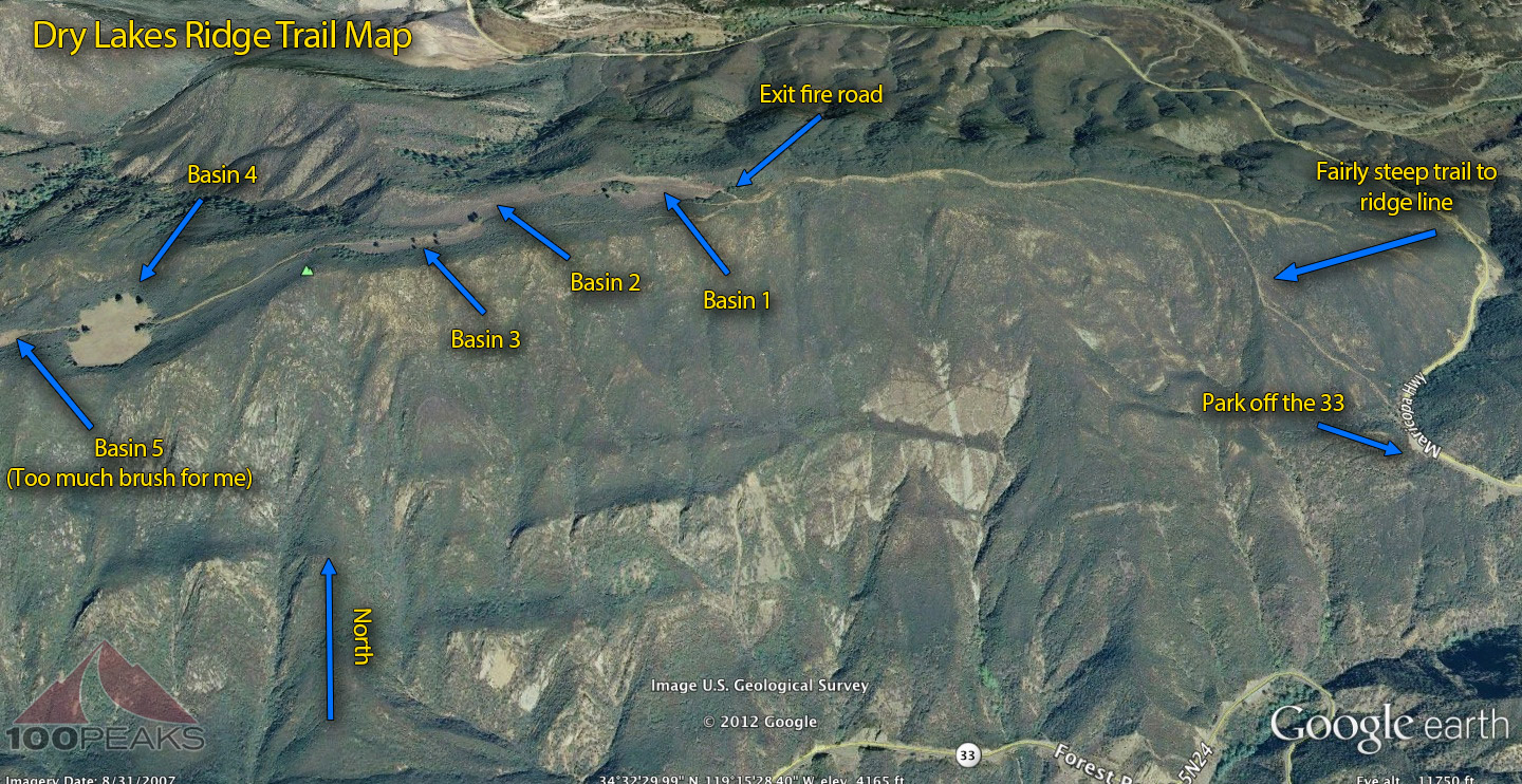
Dry Lakes Ridge Trail Map (Click to enlarge)