


Mount Whitney 2021 - Horseshoe Meadow to Mount Whitney - The Third Time's a Charm
Mount Whitney
Elevation: 14,505
Route: Horseshoe Meadow to Mount Whitney via Old Army Pass in Cottonwood Lakes Basin
Nights on Trail: 5
Miles: ~40
Shuttle: East Side Sierra Shuttle (Great!)
Trailhead: Cottonwood Lakes Trailhead
Agency: Inyo National Forest
Date Hiked: 08/11/2021 to 08/16/2021
Peakbagger.com Page
For those interested, here is a list of my gear that I have found works well for me. This is, of course, an affiliate link and your enjoyment of these may vary:
Part I: The Greatest Change of Plans
Sometimes, the things that we treasure highly do not come easily.
07/24/2021
In late July, Sophia and I packed up our stuff and headed back to Lone Pine. After getting so close to Mount Whitney last year, in 2020, we were ready to finally get to the top of this mountain so that we’d be free to explore elsewhere, in the Sierra Nevada and beyond.


After a series of bad calls on my part and the promise of a large approaching storm, we decided to spend two nights in the Cottonwood Lakes Basin and exit the area to visit Manzanar and Little Lakes Valley, before heading home. Mount Whitney would have to wait until next year.

Meeting “Legend” Jeff Garmire and Jason Fitzpatrick on the trail.
On the way up, we ran into my friend, Jason Fitzpatrick (@themuirproject) and his friend Jeff Garmire, who is known as Legend (@thefreeoutside), a prominent FKTer. We paused for a picture.
It’s always good to see Jason. We’d be backpacking the Teton Crest Trail together later in the summer.

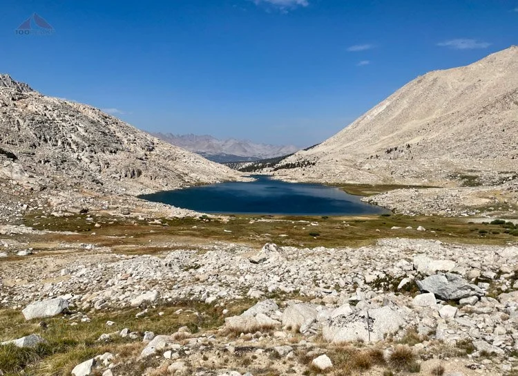
Mount Langley from Cottonwood Lake #2

Cottonwood Lake #2
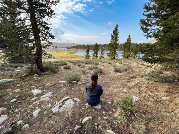
Before leaving, we spent all day enjoying Cottonwood Lake #1 and explored around the basin for a bit, finding Cottonwood Lake #2 also very beautiful. We watched the fish jump and the waterfowl swim across the lakes, and soaked our feet in the cool water, walking out to a rock and climbing on.
It was a peaceful and enjoyable day. Often, the days not spent hiking all day to get to the next camp are some of my favorite days in the wilderness.


Sophia and I make each other laugh and share the same curiosity and amazement about everything around us. We constantly say to each other, “Isn’t this gorgeous?” We play word games and find great hang-out spots.
There was a great flat granite slab several hundred feet away from our campsite where we made all of our meals. We hung out there for hours, just sharing each other’s company.
We finally got our tent ready for the evening and walked out to the lake to enjoy the twilight. Since we hadn’t slept well for a few nights, we got into our sleeping bags at around 8:30 PM. The rain started immediately and sang us to sleep.
We slept like the logs that surrounded us.
We heard rain throughout the night, but were comfortable in our tent. We had a nice breakfast watching marmots and the glistening lake and dropped back to the trailhead, using the South Fork Cottonwood Creek trail.


After getting back to our car at Whitney Portal, having only seen one group on the South Fork Cottonwood Creek Trail, we ate lunch and drove to Manzanar National Historic Site, which, in a nutshell, is an emotional museum, cataloguing how badly people can treat each other. A lifelong friend’s mom was a baby in one of these camps. I highly recommend a stop for anyone driving along the 395. It is free and worth every minute.
While walking around the garden ruins of Manzanar, giant drops of rain started falling on the valley floor. Sophia and I looked up toward the Sierra ridge line and could not see it. It was completely enshrouded in angry clouds that would not recede for the remainder of the day.

Manzanar with a vigorous storm behind it

The storm
We looked at each other, saying, “Yeesh!” simultaneously.
We believe we had made the right call to get out of the mountains. We’ve gotten used to seeing the different types of clouds in the Sierra, and these were not the nice ones.
We drove up to Bishop to stay in a hotel. We walked to get food in the rain and had a relaxing evening.
In the morning, we went to visit the busy Little Lakes Valley and could not find parking anywhere near the Mosquito Flat trailhead. We drove down to the Rock Creek Lodge and chatted with Brandon there. He was also from San Diego and promised to visit Burger Bench soon.
After a bit, we headed back up to the trailhead and found a parking spot. We gave up our first spot to a backpacker and also gave him a nice IPA to have on the trail.
We hiked out amongst the throng of day hikers and explored the ridge tops above the lakes, finding the spot where one of my photographer friends had taken a wonderful picture. I had purchased his picture years ago and it now resides on my wall in my home office.

Rock Creek in Little Lakes Valley - A very different Rock Creek from our goal
Mack Lake, Little Lakes Valley
Marsh Lake, Little Lakes Valley
We had snacks and hung out in the sun, which kept some stormy clouds at bay while we were there. It was absolutely stunning and we agreed to convince my wife to come back, perhaps staying in the lodge.
We hiked back to the car and started on the way home. We were sad to have not summited Mount Whitney, but happy to have shared this time together.
===
Part II: What a difference two weeks make
Mount Whitney Elevation Profile from Horseshoe Meadows (Click to enlarge)
One I got home, my gears started turning. I didn’t want to wait a whole year to accomplish this goal. I reviewed the calendar and remembered that, during COVID times, walk-up permits get released two weeks in advance.
I looked at when school started and asked Sophia, “If you could get back two days before school started, would you like to make another attempt this summer, rather than waiting until next year?”
“Yes! This year will be way better than next year!”
The next morning, when the rolling availability opened up, I was able to secure a permit for us to return to Cottonwood Lakes basin and attempt Mount Whitney over one of the Army Passes.
We will return in two weeks.
The food is prepped! Sophia’s on the top and mine on the bottom
===
Day 1: San Diego to Cottonwood Pass Campground

Our objective from the car
08/11/2021
In those two weeks, I went on several steep hikes with a full pack, reconfigured our menu, swapped out some gear, and chose to carry a different backpack. We decided to stay a night at Horseshoe Meadow, rather than immediately head up the trail.
We drove back up to Cottonwood Pass Trailhead at Horseshoe Meadow from San Diego and began our trip without any of my mistakes I made two weeks earlier.

Out tent at Cottonwood Lakes Campground
We timed our shuttle perfectly and spent a night at the Cottonwood Lakes trailhead. The last couple of times we stayed there, it was at the Cottonwood Pass trailhead, so this was a nice new experience on the other side of the campground.
We spent our time at the picnic table at our campsite chatting about life, eating a non-dehydrated dinner, and preparing ourselves for the journey ahead. We felt good.
Day 2: Cottonwood Pass Trailhead to Cottonwood Lake #4 - 6.5 miles
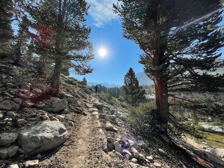
We woke up, packed our things, and got on the trail. The first section is a slight climb that drops back down to the South Fork Cottonwood Creek, where we had exited just two weeks earlier. The miles flew by quickly, as it all looked very familiar. We had all day to make it to our destination, so we took our time, enjoying the cool air of the morning, and the wonderful smell of the trees around us.


We climbed to the rim of the Cottonwood Lakes Basin and were once more met with a beautiful view of the surrounding granite peaks and the flat vista before us. Sophia’s pack was bothering her, so we made some adjustments and moved on.
We stopped for lunch at a small bench of rocks overlooking Cottonwood Lake #3. The breeze was cool, but the sun was warm. We relaxed while we ate our food and watched the twinkling water below us, as well as some chipmunks who were hoping for crumbs.
We encountered other backpackers, fisherpeople, and day hikers, but it was a weekday and wasn’t as busy as we thought it might be. We encountered almost no bugs for the entire trip.
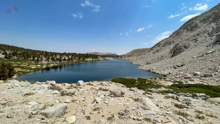
We made the last short climb to Cottonwood Lake #4 and found a nice grassy area close to the water. I paced it off and made sure it was 100’, but it was close. We were prepared for wind and rain, so we fully staked out the tent and enjoyed some time by the water.
We sat and looked up at our objective for tomorrow, Old Army Pass. It looked challenging, but we were excited to get to it. There were two other parties on the lake, but very far away. We had perfect solitude.
I went in for a dip and, as always, it felt great, even though the chilly wind made me shiver a bit. I dried off and we had dinner. The wind kicked up and escorted us into the tent for an hour or so.

Our view looking Southeast, with a group camped among the rocks across the lake
We got up to enjoy the lake under the twilight and went to bed before we could see any stars.

Our view of Old Army Pass from Cottonwood Lake #4
Day 3: Cottonwood Lake #4 to Lower Rock Creek Campground - 8 Miles
Cottonwood Lake #4 Panoramic (Click to enlarge)
We got up early and had our breakfast while watching other parties ascend Old Army Pass. It looked like a decent climb. We packed up and rose above the lake.
The trail climbed from right to left across the lower portion of the headwall, and then switched back on the left side until it became a long ramp heading right toward the low point far above.


Since it was a warm and dry year, there was no snow. Some parts were a little loose and exposed, but not much worse than anything we had encountered elsewhere. We had a good rhythm, and before long, we were at the top, being buffeted by strong winds.
Since we had a signal, we texted friends and family that we were doing great and headed down a few hundred yards to get out of the wind for a little snack.
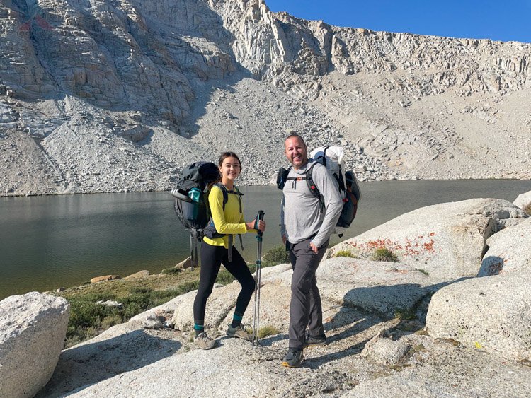
We encountered a friendly British couple, named Mike and Toni. They were very nice and we would end up leapfrogging them and camping at the same campgrounds with them for the next two days. They live in the Bay Area and go on frequent adventures around the globe.
They were currently backpacking the John Muir Trail northbound. They encouraged me to move Tasmania higher on my to do list.


We were excited to have completed the most challenging part of the day and got a good rhythm descending into the Rock Creek drainage. It started out steep and then gently dropped over many miles. We stopped at Lower Rock Creek Lake and adjusted Sophia’s backpack, as it was still bothering her. I think I got it right this time.
We hiked quickly down to the Lower Rock Creek campground, remembering how busy the upper campground was last year. However, once we arrived, we found only one party there and we had our pick of the campsites.

Lovely Rock Creek, just below our campsite
We chose one just above the creek and got settled in. We soaked our feet, spending hours at the creek, and reflected on how much stronger we felt this year. We took a little break in our tent as the rain came, but it stopped after a while and we came back out.
While we were in the tent, we chatted about the tiny hair clip that’s been in our tent on the gear loft since her first backpacking trip in 2013 to Forbush Flat in Santa Barbara. She was four years old and we had a blast. We left it in there as a reminder of how far she’s come since then.

Soph's hair clip from her first time backpacking at age 4 still remains in the tent
We messaged my wife back home and ate our dinner at the bear locker and went to bed. The sound of the creek gave me a good night’s sleep.
Day 4: Lower Rock Creek Campground to Upper Crabtree Meadow Campground - 6.75 Miles

Starting our next day, hiking up Guyot Pass to Upper Crabtree Meadow Campground


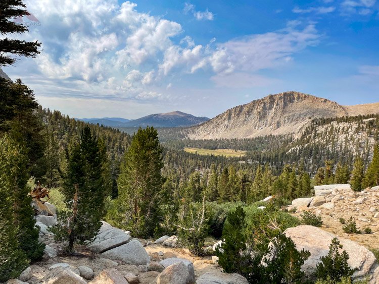
Having our usual laid-back morning, we had our breakfast and were the last people out of the campground. We ascended the now-familiar climb to Guyot Pass, having a nice rest at Guyot Creek. If we’d ever be able to make that climb at the end of the day, it would be a lovely place to camp, as there are some comfortable tent sites above and off to the right of the creek crossing. It would be more of a wilderness experience, but without a bear box, if that matters.

Lovely Guyot Creek, with nice campsites around
Fueled up, we continued climbing to the pass, remembering bits and pieces of our trek here from last year.
Before we knew it, we were at the top of Guyot Pass. The climb had felt much easier than it did the year before and we were excited to head down the other side.
We had a brief chat with a couple from Montana, and then headed down.
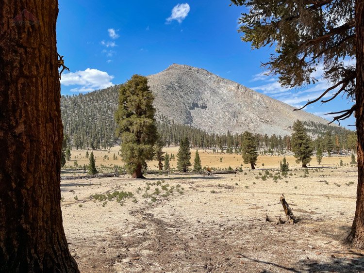
Guyot Peak from the trail
Once again, we were in familiar territory and recalled our experiences from last year. But this time, we felt much stronger. We made it to Whitney Creek and soaked our feet while we had lunch.
Last year, we had barely made it from Upper Rock Creek campground to this point and were pretty tired. This year, it was just a rest stop on the way to Upper Crabtree Campground.


Enjoying a nice lunch and foot-soaking where we camped last year at Lower Crabtree Meadow
We made the last climb to Upper Crabtree Campground, seeing another deer along the way. It felt much longer than the 1.25 miles it was, but we arrived early in the day.
We set up our tent and immediately hung out by the creek, where we would spend the next few hours soaking our feet and spending quality time together.

Our campsite at Upper Crabtree Meadow Campground
We camped near Mike and Toni and learned that they were going to summit Mount Whitney the next day. We let them know we were only headed up near Guitar Lake to get an early start the day after.
Like always, the people we meet on the trail are pleasant and happy to be there. We chatted about gear, food, and adventures and wished them luck on their ascent tomorrow.

The cloud show at Upper Crabtree Meadow Campground was amazing and lasted all afternoon
We chatted with a hiker from Montana, who came down in the afternoon. We had met him on our way up to Cottonwood Lakes. He had just summited Mount Whitney today, which was a Saturday. He said there were about 30 tents at Guitar Lake and the summit was packed. We were happy to be summiting on a Monday.
The Upper Crabtree campground had at least 20 groups scattered around the large area, with most people summiting the next day. It was still quiet and peaceful.
We spent a relaxing day around the campground, chatting a little with Mike and Toni, as we had set up our tent near them. The clouds threatened rain all day, but never delivered on the promise, until we were asleep and it hailed.

Enjoying some creek time at Whitney Creek at Upper Crabtree Meadow Campground
Looking for a nice dinner spot away from our tent, we climbed up to the top of the campground, near the ranger’s cabin, and found some excellent campsites up there, some with nice seats carved out of logs. We ate dinner in the quiet and wondered what it would be like to spend time in the ranger’s cabin nearby.
During the night, we were awakened by a loud rushing sound. A large rockfall occured up the Crabtree Creek drainage and it echoed all the way down to our campsite for several minutes.
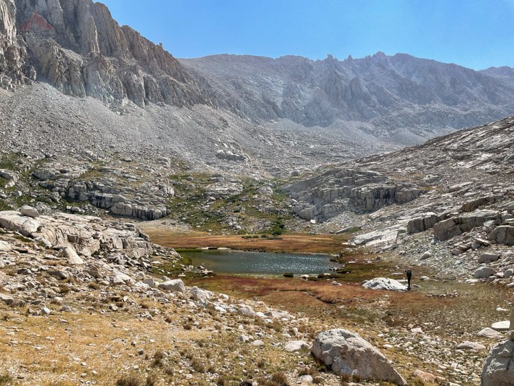
Day 5: Upper Crabtree Meadow Campground to Guitar Lake Tarn - 3.25 Miles

Hiking along Timberline Lake
Today was designed to be a light day, so that we could rest up for our summit day. Once again, we were one of the last to leave our campground, but we didn’t have far to go.

Timberline Lake
We climbed up past Timberline Lake and continued to Guitar Lake. It was amazing to recall how much harder this had felt the year before. This year, we felt good, so we kept climbing until the tarns above, our last known water. We considered going higher, in order to get closer to the summit, but we were unsure of the water situation


A backpacker we passed said the tarns did not look good for drinking, but we found them to be excellent. We hiked around to the southernmost tarn and found a nice site that has been used in the past.
We set up our tent and hung out by the tarn, watching the little beetles in various stages swimming in the water. There were no fish to be had here, since this little tarn likely freezes solid in the winter.


After a dip in the tarn and drying off in the sun, I went for a little hike to look at some other tarns toward the Hitchcock Lakes and found other secluded tent sites that looked very comfortable.
We enjoyed a long day, all to ourselves. We sat in the shade of a large boulder and chatted about everything. We were able to shout congrats to Mike and Toni across the meadow as they made their way down from Mount Whitney and back to Crabtree Meadow, to continue their northbound John Muir Trail adventure.
When the sun started setting under the cloud cover, the light was amazing, and we spent time taking a lot of photos and simply enjoying where we were.

Our campsite below the shoulder of Whitney
We had spent all day alone at this beautiful, quiet tarn at nearly 12,000’ in the shadow of Mount Whitney. We spent uninterrupted time with each other, talking about our lives and the climb tomorrow. It was one of my favorite days on the trail that I’ve had for a long time.
Example of why it's called the Range of Light (Click to enlarge)
I set the alarm for 4:30 AM and we relaxed into the tent at 8:00 PM, not wanting this beautiful day to end.
Tarn Panoramic (Click to enlarge)
Day 6: Guitar Lake Tarn to Whitney Portal - ~14.5 Miles

Hiking above our tarn on summit morning
Exactly one year to the day, we woke up with our goal of summiting Mount Whitney.
Early in the morning, I was awakened by lights shining outside the tent. At first, I thought they were meteors, since the Perseid meteor showers were going on. Since we typically went to bed before the stars were fully out, we didn’t get a chance to see them.
However, once I emerged from the tent, I realized they were the lights from headlamps from those climbers getting an alpine start. It was cool to see lights on the mountain, illuminating our future path.


Since last year the rains came at around 10:30 AM, we made sure to get an earlier start, aiming to be on the trail at 6:00 AM, which meant we didn’t need to rely upon headlamps in the grey dawn.
After a chilly breakfast, we made it on the trail on time, two hours earlier than the previous year, and started heading up the mountain. The first few climbs were challenging, but then our bodies warmed up and we had a good pace. We ate energy gels and drank plenty of water.
Looking back down with Mount Hitchcock on the left
We made excellent time, running about 2 hours earlier than our previous attempt. At Muir Trail Junction, we dropped our large packs and stopped for a brief rest and calorie load. My body was feeling strong, but every once in a while on the way up, I would feel a strange vertigo.

The rocky trail along the fangs

One of the Windows, looking east toward some tarns
At times, it got so bad, I had to sit down on a boulder just off trail for a couple of minutes. We were past the windows and turning west before the last push to the top.
I was wondering if I should continue, to the point that we talked about Sophia going alone to the top.
“No, Dad, you’re coming with me. You can do it.”
I drank some water and ate some more food and continued up. I would stop for a break when the vertigo got too intense.
My resolve hardened. I was not going to disappoint her a third time. The weather was great, my body felt strong, and we were so close. I walked for 5 minutes and took a break. I had never felt anything like this before, this derealization, which made me feel like I was watching myself hike up Mount Whitney, and then I would snap back to now.
We turned the corner and headed back east. I knew we were close. My adrenaline pumped, but I still had to sit down one more time before the hut came into view.


That hut. So powerful. It lets you know that you’re there. You’ve made it.
37 year ago, I stood there next to my father. 11 years ago, I stood there next to my brother-in-law, the PD. Now I was standing there next to my daughter.
We hugged and high-fived. Emotions flowed all over. Elation, happiness, nostalgia, and pride all welled up in me. I asked someone to take a picture of us, but I couldn’t stop breaking down and crying. I am not going to share those pictures. :)
I remembered me as a 12-year-old kid, not knowing what to expect, as I had struggled under a heavy pack and a noisy hailstorm, with a steady stream of encouragement from my dad, who also likely found the climb challenging. He was only a year younger than I am now.
I remembered 11 years ago, when I’d thought adventures like this were behind me.
I remembered last year, when I had to tell Sophia that we weren’t going to be able to make it, and how devastated we both were.
I remembered two weeks prior, how a series of mistakes made me tell her again that we were turning around.
But now we had done it, and had enjoyed the adventure along the way.
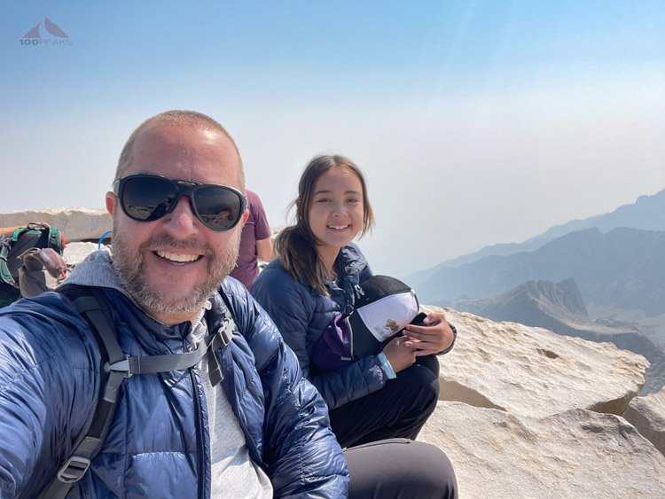
We made it!
We took a break and signed into the register and walked over to the monument. We found a spot on the edge of the mountain and sat down. The sky was hazy from several fires across the state.

She made it look easy
I leaned over and looked at the tumble of granite below. It was a long way down. I let Sophia know how proud I was of her. She was so strong. She had done it, with no elevation issues other than the expected shortness of breath.
Panoramic of Pinnacle Ridge from Mount Whitney (Click to enlarge)
She texted her mom. I got a signal and responded to some texts that I was at the top.
We were happy, but we knew we had a long way to go until we could truly relax. In what seemed like a blink of an eye, an hour had passed.
Sophia looked at the approaching clouds and said, “Dad, we should get going.”
I agreed and we got one more photo together, at the same spot my father and I did, back in 1984.

Happy father and daughter

37 years apart at Mount Whitney
Over the past hour, I had gone through the gamut of emotions and had relaxed into pride. I was the proudest father within 1000 miles, I bet.
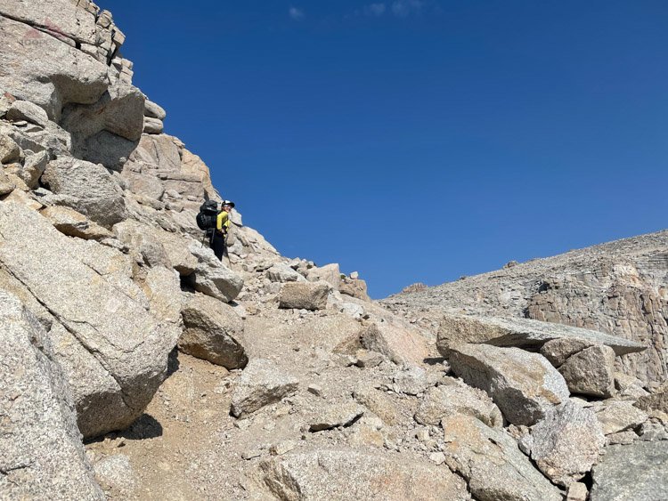
The trail along the fangs on the way down from Mount Whitney (Click to enlarge)


We started heading down and it was a lot easier, as you could imagine. I still had the vertigo from time to time, but it wasn’t as intense and I knew I was dropping to a lower elevation, which is the best thing for any elevation-related issues.
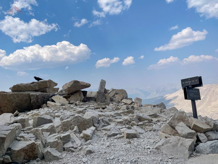
Back to John Muir Trail Junction, a raven awaits
A raven came and visited us at Muir Trail Junction, as we refuelled before continuing over Trail Crest. For some reason, that last climb between Trail Junction and Trail Crest is always very challenging. It’s likely my body shifts gears for downhill with a light pack and then is presented with a full pack and some steepness.
Climbing 300’ from 13,300’ to 13,600’ in a two-tenths of a mile can make anyone gasp.

A look back at Mount Whitney from the 99 Switchbacks
When we started down the 99 switchbacks, I would sometimes get a little vertigo when there was a ton of exposure, which is frequent on that section of the trail. But we continued on, resting, eating, and hydrating at Trail Camp.


The clouds continued to darken. We wanted to make it down the granite portions of the trail while it was dry, so we headed down and down as the day got colder and hazier.
When we reached the switchback at Trailside Meadow, large drops began to fall. We donned our rain jackets and continued as the sky opened up with rain, hail, lightning, and thunder.
We were glad we had descended when we did. The storm fell on us for an hour or so, stopping just after Mirror Lake. The wind increased as we dropped, so we kept our shells on. We met a ranger on the way up who checked our permit and greeted groups of backpackers just starting their way up.
We turned and looked up toward Mount Whitney, obscured by clouds and thunder, and wished them luck.
We had a relaxing break at Outpost Camp, knowing we could spend one more night here. However, the lure of the car and everything that goes with it was too strong. We put on our packs one last time and headed down the trail, where Sophia met a deer along the trail.


We got into a silent rhythm on those last four miles, and I could tell she was doing better than last year, when her feet were hurting more than she’d care to admit.
We both got lost in thought as the miles flew by and the sounds of civilization filtered through the trees below.
We exited through the Whitney Portal gateway, and I told her I was proud of her and l loved her. We high-fived (we’d hug later, once our packs were off) and headed down the last few hundred feet to the car.
We had done it. We were tired, but buoyed by our accomplishment. We called my wife back home and had a conversation on our way to dinner and headed home to sleep in our own beds.
As we drove home, our achievement was like a quilt around us. We had a warm elation about what we had done and felt like this opened the world up to our next adventure.
Sure, the box had been checked, but it was more than that. She had heard my stories about Mount Whitney while she was growing up and had placed it on her list of goals. She has a habit of giving herself challenges and invariably overcomes them.
I believe she cherishes these challenging and rewarding adventures with me as much as I do. We realize how much these beautiful struggles help define us. And we allow them to change us. We get a little stronger and wiser after each one.
And we don’t always get what we want on the first try. But sometimes you just have to wait a little.

Sophia’s first backpacking trip in 2013

Sometimes you get what you want

